|

|
|
| Product Information: | ||
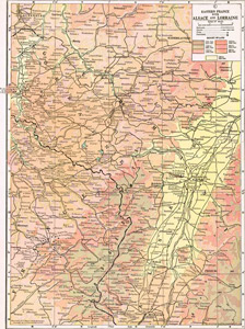
| Details: | 1910 Map of Eastern France with Alsace & Lorraine; by C.S. Hammond & Company; 1 pp; Map; 10.5x14; published: 1918; Item # FS004 This is a full color reproduction of a 1910 map of Alsace Lorraine. First published in The New Reference Atlas of the World, A New Series of Physical, Political and Historic Maps Compiled From Government Surveys and Exhibiting The Latest Results of Geographical Research .Showing Elevations, Rivers, Lakes, Roads, Cities & Towns |
|